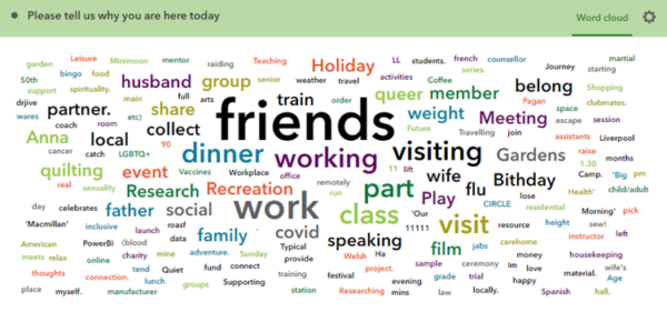
|
Using ArcGIS, we have begun to build StoryMaps with some participants who have finished the Place Study.
We use the geographical or online locations, photos, audio-clips and written responses that participants sent to us through surveys during the Place Study to create interactive digital StoryMaps of participants' experiences in these places.
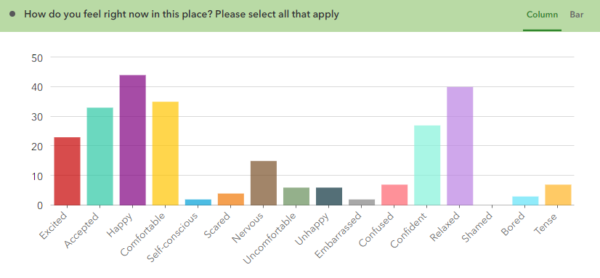
Some of the IncludeAge team met in Newcastle on 4th November to start analysing Place Study data and to practice building StoryMaps. We have some images that show a little bit of the kinds of data we have so far.
The chart below shows how mid-older people with a Learning Disability who completed the survey felt when they were filling a survey out in one particular place or space: |